GEN 2.3 Chart symbols
1. AERODROMES
1.1 CHARTS OTHER THAN APPROACH CHARTS
| Airport |  |
| Joint civil and military airport |  |
| Airfield |  |
| Heliport |  |
| Abandoned or closed aerodrome |  |
 | |
1.2 Approach charts
| The aerodrome on which the flight procedure is based |  |
| Aerodrome affecting the traffic pattern on the aerodrome on which the procedure is based |  |
2. AERODROME CHARTS
| Hard surface runway |  |
| Unpaved runway |  |
| Stopway |  |
| Taxiways and parking areas | 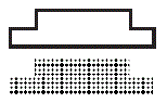 |
| Helicopter alighting area on aerodromes |  |
| Aerodrome reference point (ARP) |  |
| Runway visual range (RVR) observation site (Scatter Meter) |  |
| Transmissometer (RVR) | |
| Ceilometer |  |
| Point light |  |
| Obstacle light |  |
| Aeronautical ground light or Flashing sequence light |  |
| Threshold lights |  |
| PAPI |  |
| ILS Localizer |  |
| Collocated GPand DME facility |  |
| VHF Direction finder |  |
| Displaced threshold |  |
| Runway-holding positions Pattern A Pattern B Note: For application, see Annex 14, Volume I, paragraph 5.2.10 |  |
| Flood lights pole |  |
Landing direction indicator
|  |
Wind cone or Wind direction indicator
|  |
| Anemometer |  |
| Taxiway designation |  |
| Control tower |  |
| Fence | 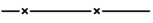 |
| Runway guard lights |  |
3. AERODROME OBSTACLE CHARTS (TYPE A)
| Plan | Profile | |
| Tree or Shrub |  |  |
| Pole, Tower, Antenna, etc. |  | |
| Buildings or large structure |  | |
| Transmission line or Overhead cable | ||
| Railroad |  | |
| Identification number |  | |
| Terrain penetrating obstacle plane |  |  |
| Wooded area penetrating obstacle plane |  |  |
| Escarpment | 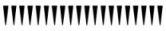 | |
| Stopway | 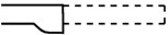 | |
| Clearway | ||
4. RADIO NAVIGATION AIDS
| Basic radio navigation aid symbol |  |
| Non-directional radio beacon (NDB) |  |
| VHF omnidirectional radio range (VOR) |  |
| Distance measuring equipment (DME) |  |
| Collocated VOR and DME facility |  |
| Radio marker beacon | |
| Compass rose orientated on the chart to the MAG North |  |
| Instrument landing system | Plan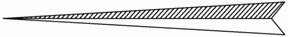 |
Profile | |
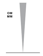
| Profiles for radio navigation aids | 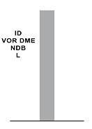 |
 | |
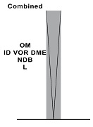 | |
| Profile view of DME distance | 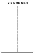 |
| Profile of a step-down fix with crossing altitude | 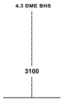 |
5. AIR TRAFFIC SERVICES
| Flight Information Region (FIR) |  |
RNAV route BI-DIRECTIONAL
|  |
RNAV route UNI DIRECTIONAL, EVEN FL
|  |
RNAV route UNI DIRECTIONAL, ODD FL
|  |
| Special instrument go-around procedure |  |
| Line of Responsibility / ATS provision boundary |  |
| State boundary |  |
| Airspace classifications |  |
Terminal control area (TMA)
| 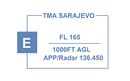 |
Control zone (CTR)
| 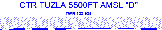 |
| Aerodrome Traffic Zone (ATZ) |  |
| Scale-break on route |  |
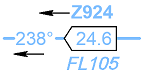
| Compulsory reporting point |  |
| Reporting point on request |  |
| Change-over point (COP) |  |
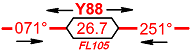
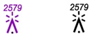
Holding pattern
| 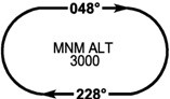 |
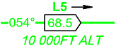
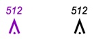
| Way-point (WPT) | Fly-over WPT |
Fly-by WPT | |
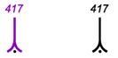
| Final approach fix (FAF) |  |
| Restricted airspace Active only as notified by NOTAM Identification of area Vertical limits
| 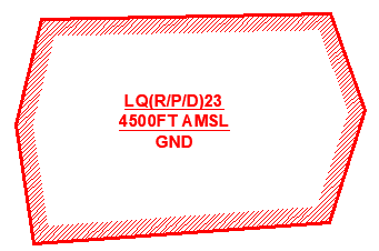 |
| Temporary reserved and segregated airspace Active only as notified by NAUP/NUUP -Identification of area -Nationality letter
-Vertical limits | 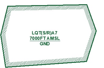 |
| Common boundary of two areas |  |
| Recommended VFR Routes |  |
| Paragliding and hang gliding activity area |  |
| Glider activity area |  |
| Area with parachute activity |  |
| Aero tow operations |  |
| Winch-launching |  |
5.1 Altitudes/flight levels
| Altitude / flight level “window” |  |
| “At or above” altitude / flight level |  |
| “At or below” altitude / flight level |  |
| “Mandatory” altitude / flight level | 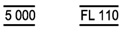 |
| Minimum flight altitude / flight level |  |
| “Expected” altitude |  |
6. OBSTACLES
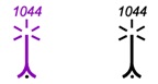
Obstacles
|   |
| Group of obstacles |  |
| Lighted group obstacles |  |
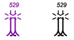
Obstacles having a height of the order of 100 M AGL
|   |
Group of obstacles having a height of the order of 100 M AGL
|  |
| Obstacles with no elevation data |  |
Obstacles
|  |
 | |
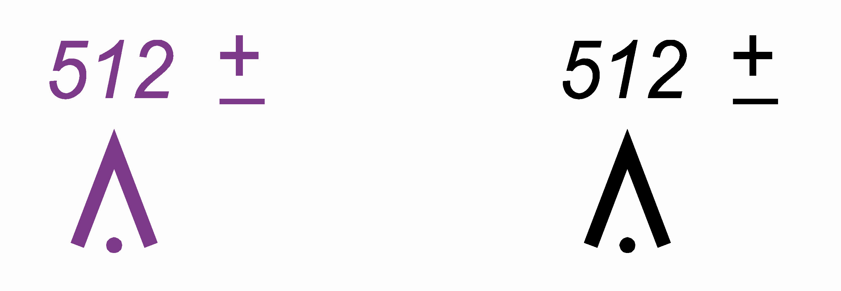
| Obstacles having a height of the order of 100 M AGL Elevation on top in FT AMSL (of doubtful accuracy) | 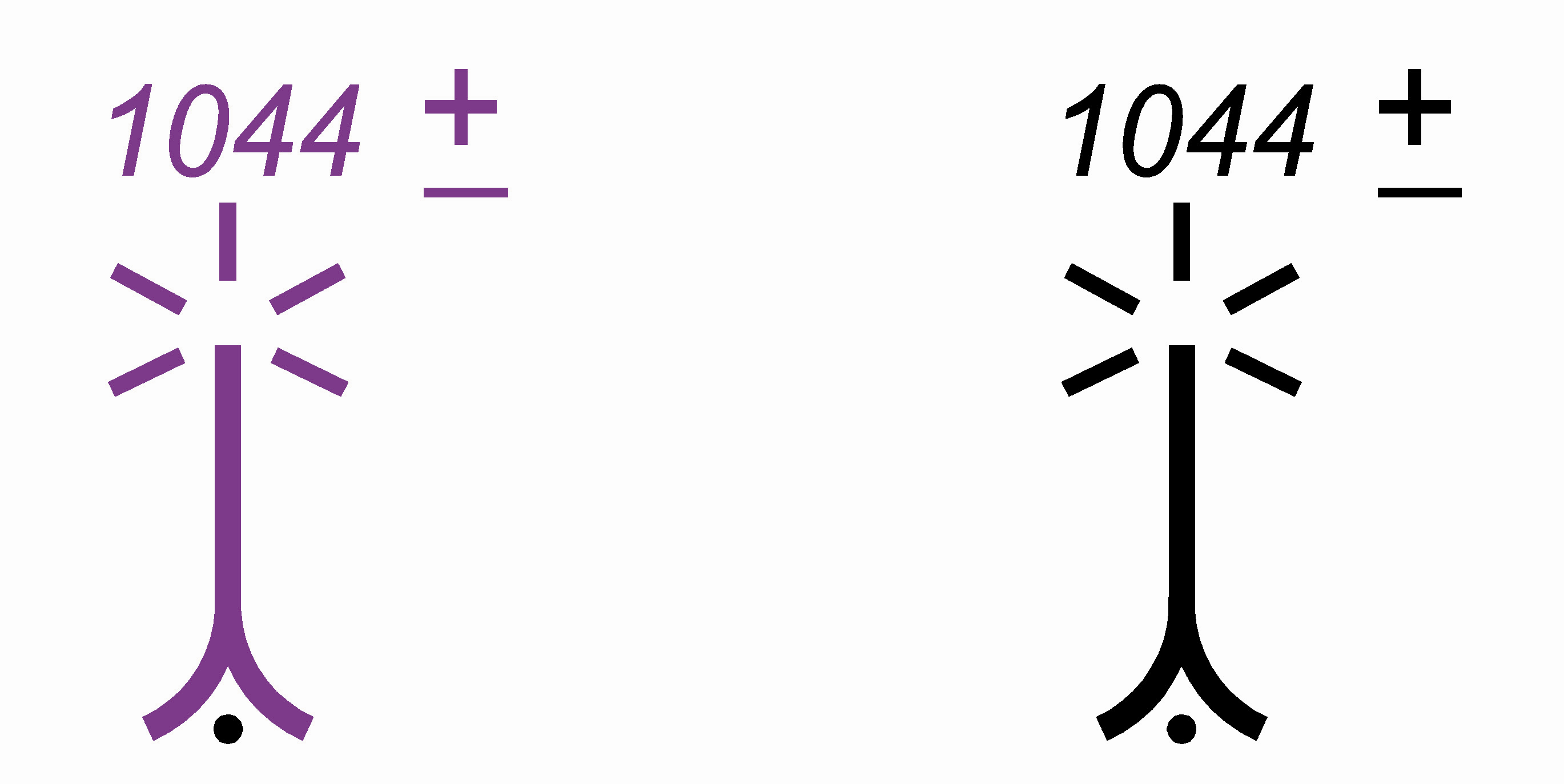 |
7. MISCELLANEOUS
| Contours |  |
| Approximate contours |  |
| Bluff, cliff or escarpment |  |
| Mountain pass with elevation in FT AMSL |  |
| Highest spot elevation on chart in FT AMSL |  |
| Spot elevation in FT AMSL |  |
| Spot elevation (of doubtful accuracy) |  |
| Area minimum altitude (AMA) |  |
| Shore line |  |
| Large river |  |
| River, small river, brooks |  |
| Lake |  |
| Swamp |  |
| Aqueduct |  |
| Spring, water hole |  |
| Reservoir |  |
| City, town |  |
| Town, village |  |
| Buildings |  |
| Railroad (single track) |  |
| Railroad (two or more tracks) | 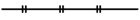 |
| Railroad bridge | 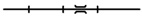 |
| Railroad tunnel | 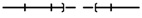 |
| Railroad station | 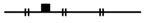 |
| Cable way | 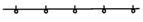 |
7.1 Higway and roads
| Dual highway |  |
| Highway |  |
| Dual highway under construction |  |
| Primary road |  |
| Secondary road |  |
| Road under construction |  |
| Road bridge |  |
| Road tunnel |  |
| Transmission line or Overhead cable | 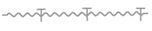 |
| Isogonic line |  |
| State boundary |  |
| Dam | 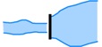 |
| Hippodrome or stadium |  |
| Ruins |  |
| Fort |  |
| Church |  |
| Mosque |  |
| Wind turbine - unlighted and lighted |  |
| Wind turbines - minor group and group in major area, lighted | 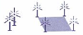 |